Gaberl Pass Road: Motorcycling Across the Gleinalpe in Austria
Locals know best!
If you travel this road often or live close by you will be given a chance to provide your valuable rating soon! Sign in and stay connected.Location and Route Overview
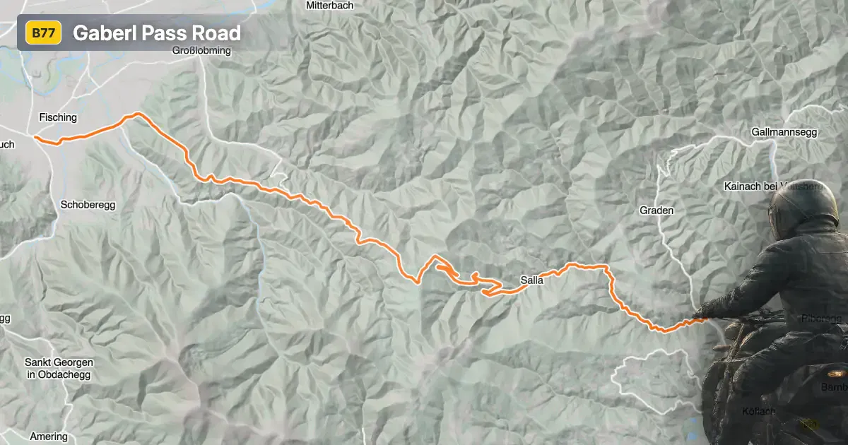
Gaberl Straße is situated in the Austrian state of Styria, forming a vital connection between the towns of Zeltweg and Köflach. The road ascends through the Gaberl Pass, reaching a maximum elevation of 1,551 m (5,089 ft), and crosses the Gleinalpe mountain range. Along its route, it passes through settlements such as Salla and Gaberl, providing access to both inhabited areas and remote alpine landscapes. The road's strategic location makes it a favored choice for motorcyclists exploring the eastern Alps. An interactive map showing the Gaberl Pass Road can be found at the end of the article.
Loading road width, lane configuration, and surface quality dataOpen Map Explorer for More Road DetailsRoad Characteristics and Riding Experience
The Gaberl Pass Road extends for approximately 37.2 km (23.1 miles), with the majority (about 90%) featuring wide, two-lane sections. The surface is asphalt and is generally rated as excellent, offering a smooth and reliable ride. The road is moderately curvy, providing a balance between technical riding and comfortable touring. Elevation ranges from 513 m (1,683 ft) at its lowest point to 1,548 m (5,079 ft) near the summit, with the Gaberl Pass itself peaking at 1,551 m (5,089 ft). Speed limits vary between 50 km/h (31 mph) and 70 km/h (43 mph), reflecting the road's mix of open stretches and tighter bends. Approximately 40% of the route passes through inhabited areas, while the remainder traverses open alpine terrain.
Mountain Pass and Surrounding Attractions
The highlight of the route is the Gaberl Pass, a historic crossing point in the region. The road also intersects the Gleinalpe and Lavanttal Alps, offering expansive views and access to hiking trails. The nearby towns of Zeltweg and Köflach provide amenities and serve as convenient starting or ending points for the journey. The region is also known for its alpine meadows and traditional Styrian culture, making it a worthwhile destination beyond the ride itself.
Road Closures and Seasonal Considerations
The Gaberl Pass Road is subject to seasonal closures, particularly during winter months when snow and ice can make the route impassable. Motorcyclists should check local traffic reports or the ASFINAG road conditions website for up-to-date information on closures and weather-related restrictions. There are no permanent closures for motorcycles, but temporary restrictions may occur due to maintenance or adverse weather conditions.
Tolls, Fees, and Practical Information
Currently, there is no toll or entrance fee specifically for using the Gaberl Pass Road. However, toll conditions in Austria may change, and it is advisable to consult the ASFINAG toll information page for the latest updates on road charges and vignette requirements. Riders should also be aware of general Austrian traffic regulations, including speed limits and safety equipment mandates.
| ROAD SCORE | ROAD ARTICLE |
|---|---|
4.4 | Motorcycling the Packsattel Pass: Wolfsberg to Köflach |
5.4 | Exploring the St. Pankrazen-Straße: A Motorcyclist’s Guide through the Gleinalpe |
4.8 | Exploring the Gleinalpe Crossing: Gratwein-Straßengel to Bärnbach by Motorcycle |
| ROAD SCORE | ROAD ARTICLE |
|---|---|
8.6 | Exploring the Nockalm Road (Nockalmstraße): A Premier Alpine Motorcycle Route in Austria |
6.6 | Hahntennjoch (Hahntennjoch): A Technical Overview for Motorcyclists |
2.4 | Gerlos Alpine Road (Gerlos Alpenstraße): A Technical Overview for Motorcyclists |