Exploring the Hauptplatz–Krems-Brücke Route: A Motorcyclist’s Guide
Locals know best!
If you travel this road often or live close by you will be given a chance to provide your valuable rating soon! Sign in and stay connected.Location and Overview of the Hauptplatz–Krems-Brücke Route
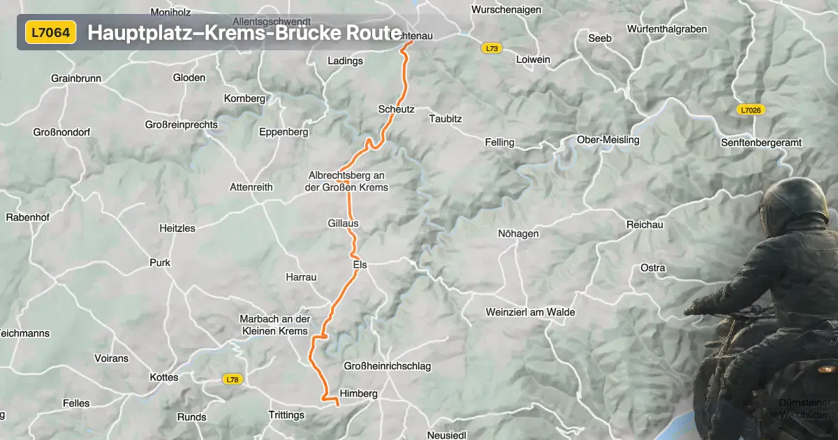
The Hauptplatz–Krems-Brücke route is situated in Lower Austria, traversing a region known for its rolling hills and proximity to the Danube River. The road connects the settlements of Hauptplatz and Krems-Brücke, with the town of Gföhl located approximately 7.3 km (4.5 miles) from the starting point. The route’s position in the Waldviertel area places it within reach of several local attractions, while its partial adjacency to the Große Krems river adds a natural element to the ride. An interactive map showing the route is available at the end of this article.
Loading road width, lane configuration, and surface quality dataOpen Map Explorer for More Road DetailsRoad Characteristics and Riding Experience
This route extends for approximately 13.9 km (8.6 miles), with the majority of the surface composed of high-quality asphalt. Riders will find the road to be gently curved, offering a moderate level of curviness that is suitable for both experienced and less seasoned motorcyclists. The surface quality is rated as excellent, ensuring a comfortable and predictable ride. Most of the road is wide (about 76%), with a smaller portion being of medium width, and only a minimal section classified as narrow. The route is predominantly single-lane (about 87%), with a small segment featuring two lanes. Approximately half of the journey passes through inhabited areas, providing a mix of open countryside and village environments.
Natural Features and Points of Interest
The Hauptplatz–Krems-Brücke route runs alongside the Große Krems river for a short stretch, offering glimpses of the waterway as it makes its way toward the Danube. The surrounding region is characterized by gentle hills and agricultural landscapes, typical of the Waldviertel. While the road itself does not pass directly through major tourist attractions, its proximity to Gföhl provides access to local amenities and serves as a gateway to further exploration in Lower Austria. The nearby Danube valley and the historic city of Krems an der Donau are within reasonable riding distance, offering additional opportunities for sightseeing.
Seasonal Accessibility and Road Regulations
The Hauptplatz–Krems-Brücke route remains open to motorcycles throughout the year, with no regular seasonal closures reported. However, riders should be aware that winter conditions in Lower Austria can affect road safety, particularly during periods of snow or ice. There are no known event-related closures specific to this route. The maximum speed limit varies between 50 km/h (31 mph) in inhabited areas and 100 km/h (62 mph) in rural sections, in accordance with Austrian traffic regulations. It is advisable to monitor local weather forecasts and road condition updates before planning a ride, especially during the colder months.
Tolls, Fees, and Further Information
There are currently no tolls or entrance fees required to ride the Hauptplatz–Krems-Brücke route. Riders should note that toll conditions may change in the future, and it is recommended to consult official resources for the most up-to-date information. For details on road tolls and entrance fees in Austria, visit the ASFINAG Vignette Information page. This resource provides comprehensive guidance on toll requirements for motorcycles and other vehicles across the country.
| ROAD SCORE | ROAD ARTICLE |
|---|---|
4.1 | Exploring the Els–Krems an der Donau Route: A Motorcyclist’s Guide |
4.7 | Exploring the Ottenschlager Straße: A Motorcyclist’s Guide Through Austria’s Wachau Valley |
5.1 | Exploring the Ottenschlag–Weißenkirchen Wachau Route: A Motorcyclist’s Guide |
| ROAD SCORE | ROAD ARTICLE |
|---|---|
4 | Turracher Höhe Pass (Turracher Höhe): A Technical Overview for Motorcyclists |
4.6 | Katschberg Pass (Katschbergpass) - B99: A Technical Overview for Motorcyclists |
3 | Koppen Pass (Koppenpass): A Technical Overview for Motorcyclists |