Exploring Zwettler Straße – Linzer Straße: A Motorcyclist’s Guide Through Upper Austria
Locals know best!
If you travel this road often or live close by you will be given a chance to provide your valuable rating soon! Sign in and stay connected.Location and Route Overview
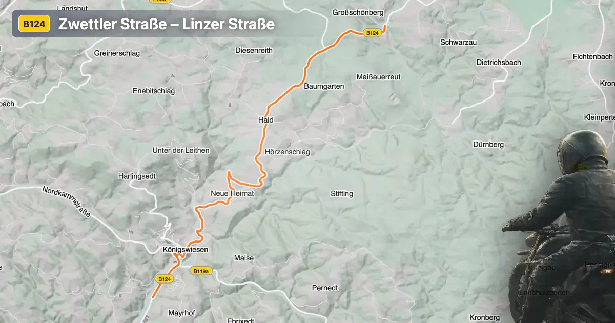
Zwettler Straße – Linzer Straße is situated in the northern part of Upper Austria, within the Mühlviertel region. The road primarily connects the settlements of Zwettl an der Rodl and Markt, traversing a landscape characterized by rolling hills, forests, and agricultural land. The route serves as a connector between local communities and provides access to the broader regional road network. Riders can expect a blend of rural scenery and small-town charm along the way. An interactive map showing the road’s course is available at the end of this article.
Loading road width, lane configuration, and surface quality dataOpen Map Explorer for More Road DetailsRoad Characteristics and Riding Experience
The Zwettler Straße – Linzer Straße covers a distance of approximately 10.6 km (6.6 miles). The road surface is asphalt and is generally rated as very good, offering a smooth and predictable ride. The route is moderately curvy, with a mix of gently winding sections and straighter stretches, making it suitable for riders of varying skill levels. Most of the road (about 95%) features two lanes, providing ample space for overtaking and comfortable riding. The width is predominantly wide (about 63%), with the remainder being of medium width. The elevation ranges from 564 m (1,850 ft) to 847 m (2,779 ft), offering some mild elevation changes but no significant mountain passes. Approximately half of the route passes through inhabited areas, so riders should remain attentive to local traffic and potential speed restrictions.
Speed Limits, Traffic, and Seasonal Considerations
The maximum speed limit along Zwettler Straße – Linzer Straße is typically 100 km/h (62 mph) in rural sections and 50 km/h (31 mph) within inhabited areas. Riders should be aware of posted speed limits, as they may vary depending on local regulations and specific road conditions. There are no known seasonal closures for this road; it remains accessible throughout the year. However, winter conditions in Upper Austria can lead to icy or snowy surfaces, so caution is advised during colder months. There are no motorcycle-specific restrictions or event-related closures reported for this route.
Tolls, Fees, and Additional Information
Zwettler Straße – Linzer Straße does not currently require a toll or entrance fee for motorcycles or other vehicles. Riders should note that toll conditions may change in the future, and it is advisable to verify the latest information before planning a trip. For up-to-date details on road tolls and fees in Austria, consult the official ASFINAG toll information website.
Points of Interest and Nearby Attractions
While the Zwettler Straße – Linzer Straße itself is primarily a functional regional road, the surrounding Mühlviertel region offers several attractions worth exploring. Zwettl an der Rodl is known for its traditional Austrian architecture and local gastronomy. The nearby Bad Leonfelden spa town is a popular destination for relaxation and wellness. Additionally, the Mühlviertel landscape is ideal for outdoor activities such as hiking and cycling, making it a versatile area for motorcyclists seeking to combine riding with other pursuits.
| ROAD SCORE | ROAD ARTICLE |
|---|---|
4.4 | Exploring the Maascher Straße: A Motorcyclist’s Guide Through Upper Austria |
4.5 | Exploring the B4 Road: A Motorcyclist’s Guide through Lower Austria |
4.7 | Exploring the Freistadt–Unterweißenbach Route: A Motorcyclist’s Guide |
| ROAD SCORE | ROAD ARTICLE |
|---|---|
4.6 | Katschberg Pass (Katschbergpass) - B99: A Technical Overview for Motorcyclists |
6.7 | Staller Saddle (Staller Sattel / Passo di Stalle): A Technical Overview for Motorcyclists |
6.6 | Hahntennjoch (Hahntennjoch): A Technical Overview for Motorcyclists |