Exploring the D29: Riding Through Medvednica Nature Park
Locals know best!
If you travel this road often or live close by you will be given a chance to provide your valuable rating soon! Sign in and stay connected.Location and Route Overview
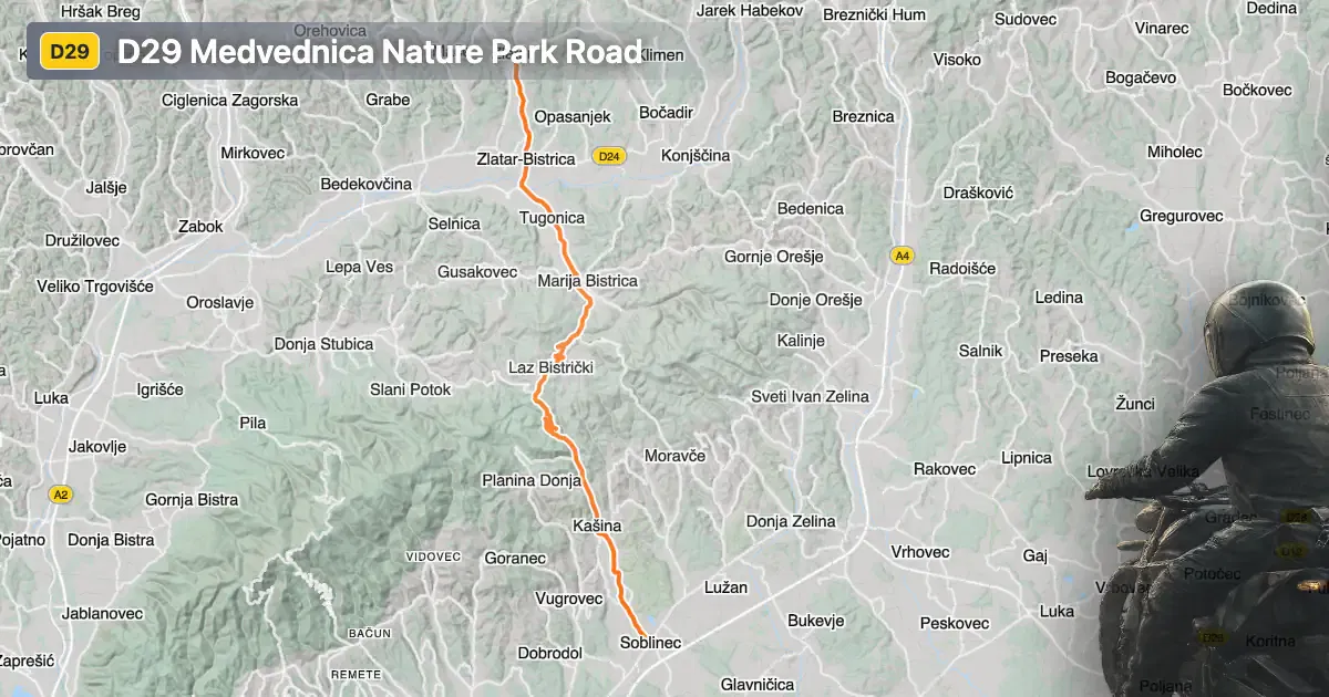
The Državna cesta D29, commonly referred to as the D29, is a state road in northern Croatia. It begins near the town of Zlatar and extends southward to Sesvete, a district of Zagreb. The route passes through several settlements, including Zagrebačka ulica, Cesta Ivana Mažuranića, Podgrađe - Tugonica, Prepuštovečka ulica, Glavna ulica, Soblinečka cesta, Zagorska ulica, Ulica Vladimira Nazora, Vurnovečka ulica, and Soblinečka ulica. A significant portion of the D29 traverses the Medvednica Nature Park, a protected area known for its forested hills and recreational opportunities. An interactive map showing the D29 route can be found at the end of this article.
Loading road width, lane configuration, and surface quality dataOpen Map Explorer for More Road DetailsRoad Characteristics and Riding Experience
The D29 covers a distance of approximately 33.2 km (20.6 miles), with the majority of the road featuring a wide, two-lane configuration (about 88%). The surface is asphalt and is generally rated as excellent, providing a smooth ride for motorcyclists. The road is not particularly twisty, offering gently curved sections that are suitable for riders seeking a relaxed journey rather than a highly technical ride. Elevation along the route ranges from 131 m (430 ft) to 416 m (1,365 ft), with gradual climbs and descents as the road passes through the Medvednica hills. About 29.7% of the D29 passes through inhabited areas, so riders should be mindful of local traffic and speed regulations.
Medvednica Nature Park and Nearby Attractions
One of the highlights of the D29 is its passage through Medvednica Nature Park. The park is a popular destination for outdoor enthusiasts, offering hiking trails, mountain biking, and the historic Medvedgrad Fortress. The proximity to Zagreb also makes the D29 a convenient route for those looking to explore both natural and urban attractions. The towns of Zlatar and Sesvete serve as gateways to the route, providing access to local amenities and services for travelers.
Speed Limits, Road Safety, and Seasonal Considerations
Speed limits on the D29 vary depending on the section, with posted limits of 30, 40, 50, 60, and 70 km/h (19, 25, 31, 37, and 43 mph). Riders should pay close attention to signage, especially in inhabited areas and within the boundaries of Medvednica Nature Park. The road is open year-round and there are no regular seasonal closures for motorcycles. However, weather conditions in the Medvednica hills can change rapidly, particularly in winter, so caution is advised during adverse weather. There are no known event-related closures affecting the D29 at this time.
Tolls, Fees, and Practical Information
Currently, there are no tolls or entrance fees required to ride the D29, including the section passing through Medvednica Nature Park. Riders should note that toll conditions may change in the future, and it is advisable to check for updates before planning a trip. For more information about road tolls and entrance fees in Croatia, visit the Hrvatske autoceste website. Facilities such as fuel stations and rest areas are available in the larger settlements along the route, particularly near Zlatar and Sesvete.
| ROAD SCORE | ROAD ARTICLE |
|---|---|
4.8 | Exploring Županijska cesta 2221: A Motorcyclist’s Guide through Northern Croatia |
4.7 | Exploring the D307: A Motorcyclist’s Guide to the Donja Stubica–Marija Bistrica Route |
5.3 | Exploring Županijska cesta 2128: A Technical Overview for Motorcyclists |
| ROAD SCORE | ROAD ARTICLE |
|---|---|
8.7 | Riding the Poklon Pass: Exploring Županijska cesta 5047 through Učka Nature Park |
7 | Exploring the Rijeka–Gornje Jelenje Pass: A Motorcyclist’s Guide |
7 | Adriatic Route - Jadranska Magistrala - Velebit Coastal Route |