Exploring the Vrgorac Hinterland Route: A Motorcyclist’s Guide
Locals know best!
If you travel this road often or live close by you will be given a chance to provide your valuable rating soon! Sign in and stay connected.Location and Access
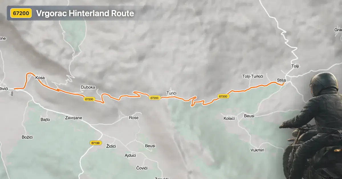
The Vrgorac Hinterland Route is situated in southern Croatia, in the vicinity of the town of Vrgorac. This area lies inland from the Adriatic coast, offering a quieter alternative to the busier coastal highways. The road begins approximately 6.4 km (4 miles) from Vrgorac, making the town a convenient base for riders. The region is characterized by rolling hills and agricultural landscapes, providing a distinct contrast to the nearby Dalmatian coastline. An interactive map showing the route can be found at the end of this article.
Loading road width, lane configuration, and surface quality dataOpen Map Explorer for More Road DetailsRoad Characteristics and Riding Experience
The Vrgorac Hinterland Route extends for approximately 6.5 km (4 miles), with an elevation range from 405 m (1,329 ft) to 634 m (2,080 ft). The road is predominantly gently curved, offering a moderate level of technical challenge suitable for a wide range of riders. The asphalt surface is of good quality, providing reliable grip and comfort. Most of the route consists of a single lane (about 90%), with the majority of the road being of medium width (about 65%). Narrow and wide sections are present but less common. The route passes almost entirely through uninhabited areas, with only a small proportion (2.7%) traversing settlements, ensuring minimal traffic and a peaceful riding environment.
Nearby Attractions and Points of Interest
While the road itself is primarily rural, the proximity to Vrgorac offers opportunities to explore local attractions. The town of Vrgorac is known for its historic old town, traditional stone architecture, and the nearby Matica River. The region is also recognized for its vineyards and agricultural products, particularly strawberries and wine. Riders interested in cultural experiences can visit the local markets or explore the surrounding countryside, which features karst landscapes and panoramic views of the Biokovo mountain range. For those seeking further adventure, the Biokovo Nature Park is within reach, offering hiking and additional riding opportunities.
Road Closures and Seasonal Considerations
There are currently no known restrictions or closures for motorcycles on the Vrgorac Hinterland Route. The road remains open throughout the year, although weather conditions can vary, particularly during the winter months when occasional rain or fog may affect visibility and traction. Riders are advised to check local weather forecasts before setting out. There are no regular event-related closures reported for this route.
Tolls, Fees, and Practical Information
The Vrgorac Hinterland Route does not require the payment of tolls or entrance fees for motorcycles. However, toll conditions may change in the future, and riders are encouraged to verify the latest information before traveling. For up-to-date details on road tolls and regulations in Croatia, consult the official Hrvatske autoceste website. Fuel stations and basic services are available in Vrgorac, so it is advisable to refuel and stock up on supplies before embarking on the route.
| ROAD SCORE | ROAD ARTICLE |
|---|---|
4.5 | Riding the Milina Zasida Pass: Exploring Županijska cesta 6201 in Croatia |
5.3 | Exploring the Duge Njive–Dragljane Road: A Technical Overview for Motorcyclists |
| ROAD SCORE | ROAD ARTICLE |
|---|---|
8.7 | Riding the Poklon Pass: Exploring Županijska cesta 5047 through Učka Nature Park |
7 | Exploring the Rijeka–Gornje Jelenje Pass: A Motorcyclist’s Guide |
7 | Adriatic Route - Jadranska Magistrala - Velebit Coastal Route |