Exploring the 658 Dobliče – Brezovica Route: A Motorcyclist’s Guide Through Poljanska Dolina and Poljanska Gora
Locals know best!
If you travel this road often or live close by you will be given a chance to provide your valuable rating soon! Sign in and stay connected.Location and Route Overview
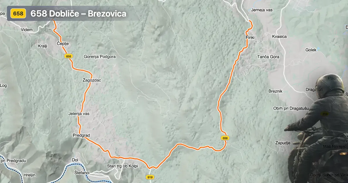
The 658 Dobliče – Brezovica road is situated in southern Slovenia, traversing the region between the villages of Dobliče and Brezovica pri Predgradu. The route passes through several settlements, including Tanča Gora, Močile, Stari trg ob Kolpi, Deskova vas, and Zagozdac. This area is known for its proximity to the Poljanska dolina valley and the Poljanska gora mountain range, offering a mix of valley and upland riding environments. The road’s southern terminus is near Brezovica pri Predgradu, while the northern end approaches the town of Črnomelj, located approximately 4.5 km (2.8 miles) from the starting point. An interactive map showing the road can be found at the end of the article.
Loading road width, lane configuration, and surface quality dataOpen Map Explorer for More Road DetailsRoad Characteristics and Riding Experience
The 658 Dobliče – Brezovica route extends for approximately 19.4 km (12.1 miles), with an elevation range from 210 m (689 ft) to 569 m (1,867 ft). The road surface is asphalt, with a quality that can be described as moderate—neither poor nor excellent, but generally reliable for motorcycle travel. Riders will encounter a mix of one-lane (about 59%) and two-lane (about 28%) sections, with the majority of the road being of medium width (about 62%). The route is moderately curvy, presenting a balance between straight stretches and gently winding segments, making it suitable for riders of varying skill levels. Approximately 20% of the road passes through inhabited areas, providing occasional opportunities for rest or refueling in local villages such as Stari trg ob Kolpi and Črnomelj.
Natural Features and Points of Interest
This road is notable for its passage through the Poljanska dolina valley and its crossing of the Poljanska gora mountain range. The valley section, which comprises about a quarter of the route, offers views of traditional Slovenian rural landscapes and forested hills. The ascent over Poljanska gora introduces more elevation changes and a sense of remoteness, with the road weaving through wooded terrain. Riders may also wish to explore the nearby Kolpa River, a popular destination for outdoor activities such as kayaking and fishing. The settlements along the route, including Tanča Gora and Deskova vas, provide glimpses into local culture and architecture.
Road Closures, Seasonal Access, and Regulations
The 658 Dobliče – Brezovica road is generally open to motorcycles throughout the year. However, due to its elevation and the presence of forested and mountainous sections, winter conditions can occasionally lead to temporary closures or hazardous riding surfaces, particularly after heavy snowfall or during periods of ice. There are no permanent restrictions for motorcycles, but riders should consult local authorities or the Slovenian Traffic Information Center for up-to-date information on closures or roadworks. Event-related closures are rare, but local festivals or maintenance projects may occasionally affect access.
Tolls, Fees, and Practical Information
There are currently no tolls or entrance fees required for motorcycles on the 658 Dobliče – Brezovica road. Riders should be aware that toll conditions may change in the future, and it is advisable to verify the latest information before planning a trip. For comprehensive details on road tolls and fees in Slovenia, visit the DARS (Motorway Company in the Republic of Slovenia) website. Fuel stations and basic amenities are available in larger settlements such as Črnomelj, while smaller villages along the route offer limited services.
| ROAD SCORE | ROAD ARTICLE |
|---|---|
4.7 | Exploring the Livold–Brezovica–Kanižarica Route: A Motorcyclist’s Guide |
4.4 | Exploring the Livold–Brezovica–Kanižarica Route: A Motorcyclist’s Guide |
| ROAD SCORE | ROAD ARTICLE |
|---|---|
8 | Riding the Magnovec Pass: Ajdovščina to Lokve by Motorcycle |
7.4 | Riding the Podmeja Pass: Žalec to Trbovlje by Motorcycle |
7.4 | Strma Reber Pass: Motorcycling the 656 Kočevska Reka – Osilnica Road |