Exploring the Vrhnika Viewpoint Road: A Motorcyclist’s Guide
Locals know best!
If you travel this road often or live close by you will be given a chance to provide your valuable rating soon! Sign in and stay connected.Location and Regional Context
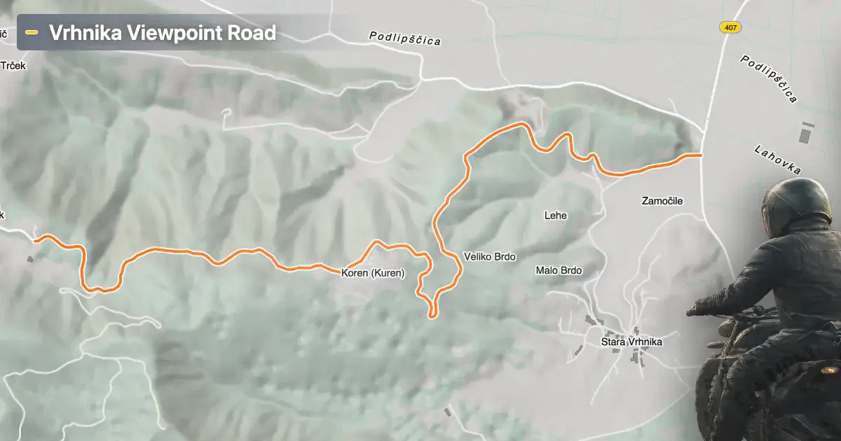
Vrhnika 116 is situated in central Slovenia, traversing the Ljubljanska kotlina, a basin known for its diverse landscapes and proximity to the capital, Ljubljana. The road’s endpoints are both near the town of Vrhnika, a settlement with historical significance and a gateway to the region’s natural attractions. The route’s location within the basin provides riders with a mix of open views and wooded stretches. An interactive map showing the road’s course is available at the end of this article.
Loading road width, lane configuration, and surface quality dataOpen Map Explorer for More Road DetailsRoad Characteristics and Riding Experience
The Vrhnika Viewpoint Road extends for approximately 5.6 km (3.5 miles), offering a ride that is notably twisty, with a curviness rating above average. The asphalt surface is of high quality, providing a smooth and predictable grip for motorcycles. The road maintains two lanes throughout its length (about 100%), with the width varying between narrow, middle, and wide sections—the majority being wide (about 50%). Elevation ranges from 301 m (988 ft) at its lowest point to 640 m (2,100 ft) at its highest, giving riders a moderate climb and descent. About a quarter of the route passes through inhabited areas, but much of the ride is characterized by open countryside and forested segments.
Attractions Along the Route
One of the highlights of this road is its proximity to a local viewpoint, offering expansive vistas over the Ljubljanska kotlina. While the viewpoint itself is unnamed in official sources, the area is known for its panoramic perspectives, especially near Vrhnika. Riders may wish to pause and take in the landscape, which is particularly striking during clear weather. The region’s natural beauty is complemented by its cultural heritage, with Vrhnika serving as a starting point for exploring the basin’s historical and environmental sites. For more information about the basin, visit the Ljubljanska kotlina page.
Road Access, Closures, and Fees
There are currently no known restrictions or seasonal closures affecting motorcycle access on the Vrhnika Viewpoint Road. The route remains open year-round, barring temporary closures due to maintenance or local events. No tolls or entrance fees are required to ride this road, but riders should be aware that toll conditions may change in the future. For up-to-date information on road tolls and regulations in Slovenia, consult the official DARS website.
Practical Information for Motorcyclists
Given the road’s high-quality surface and variable width, it is suitable for a range of motorcycles, from touring bikes to sportier models. The twisty nature of the route rewards attentive riding, especially in narrower sections. Speed limits typically align with Slovenian rural road standards, generally set at 90 km/h (56 mph) unless otherwise posted. Riders should remain vigilant for local traffic, particularly in inhabited segments. Facilities are available in Vrhnika, including fuel stations, cafes, and accommodation options, making it a convenient base for further exploration of the region.
| ROAD SCORE | ROAD ARTICLE |
|---|---|
4.7 | Exploring the 407 Gorenja vas – Vrhnika Route: A Motorcyclist’s Guide Through Polhograjsko Hribovje |
5 | Exploring the Vrhnika–Žiri Road: A Technical Overview for Motorcyclists |
| ROAD SCORE | ROAD ARTICLE |
|---|---|
8 | Riding the Magnovec Pass: Ajdovščina to Lokve by Motorcycle |
7.4 | Riding the Podmeja Pass: Žalec to Trbovlje by Motorcycle |
7.4 | Strma Reber Pass: Motorcycling the 656 Kočevska Reka – Osilnica Road |