Exploring the Domovinskog rata – Progon Route: A Technical Overview for Motorcyclists
Locals know best!
If you travel this road often or live close by you will be given a chance to provide your valuable rating soon! Sign in and stay connected.Location and Access
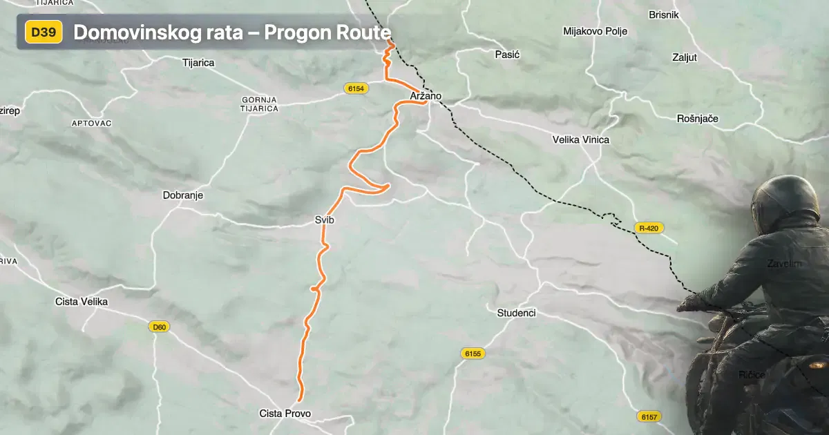
The Domovinskog rata – Progon route is situated in southern Croatia, traversing the Dalmatian hinterland. The road connects the settlements of Cesta Josipa Jovića, Domovinskog rata, and Progon, with the village of Cista Provo serving as the nearest settlement to the starting point. The route runs in a generally north-south direction, providing access to local communities and acting as a connector between rural and more urbanized areas. An interactive map showing the road can be found at the end of the article.
Loading road width, lane configuration, and surface quality dataOpen Map Explorer for More Road DetailsTechnical Road Details
The Domovinskog rata – Progon route extends for approximately 16.1 km (10 miles), with an elevation range from 479 m (1,572 ft) to 808 m (2,651 ft). The road is predominantly wide (about 98%), with two lanes making up the vast majority of its length (about 98%). The asphalt surface is of excellent quality, providing a smooth and predictable riding experience. The road is gently curved, offering a relaxed ride suitable for a variety of motorcycles. Only a small portion (about 17.3%) passes through inhabited areas, allowing for consistent speeds and minimal interruptions. Speed limits along the route vary, with posted limits of 50 km/h (31 mph), 30 km/h (19 mph), and 20 km/h (12 mph) in certain sections, particularly near settlements and intersections.
Local Significance and Attractions
While the Domovinskog rata – Progon route is primarily a functional connector, it passes through areas of local historical and cultural interest. The road itself is named in reference to Croatia's Homeland War (Domovinski rat), reflecting the region's modern history. Nearby, the village of Cista Provo is known for its traditional Dalmatian architecture and rural landscapes. Riders interested in exploring the broader area may consider visiting the city of Imotski, famous for the Blue Lake and Red Lake, both unique karst phenomena located within a short ride from the route.
Road Closures and Seasonal Considerations
There are currently no known restrictions or closures for motorcycles on the Domovinskog rata – Progon route. The road remains open year-round, as the region experiences a Mediterranean climate with mild winters. However, occasional maintenance or local events may result in temporary closures or detours. Riders are advised to check local traffic updates before departure, especially during periods of adverse weather or public events.
Tolls, Fees, and Additional Information
The Domovinskog rata – Progon route does not currently require the payment of tolls or entrance fees for motorcycles. Riders should be aware that toll conditions may change in the future. For the most up-to-date information on road tolls and entrance fees in Croatia, consult the official resource at Hrvatske autoceste.
| ROAD SCORE | ROAD ARTICLE |
|---|---|
4.6 | Exploring Državna cesta D60: A Technical Overview for Motorcyclists |
4.3 | Exploring Ulica Lovrećkih žrtava: A Technical Overview for Motorcyclists |
4 | Exploring Lokalna cesta 67142: A Technical Ride in the Dalmatian Hinterland |
| ROAD SCORE | ROAD ARTICLE |
|---|---|
8.7 | Riding the Poklon Pass: Exploring Županijska cesta 5047 through Učka Nature Park |
7 | Exploring the Rijeka–Gornje Jelenje Pass: A Motorcyclist’s Guide |
7 | Adriatic Route - Jadranska Magistrala - Velebit Coastal Route |