Exploring the Labin–Raša Route: A Technical Overview for Motorcyclists
Locals know best!
If you travel this road often or live close by you will be given a chance to provide your valuable rating soon! Sign in and stay connected.Location and Regional Context
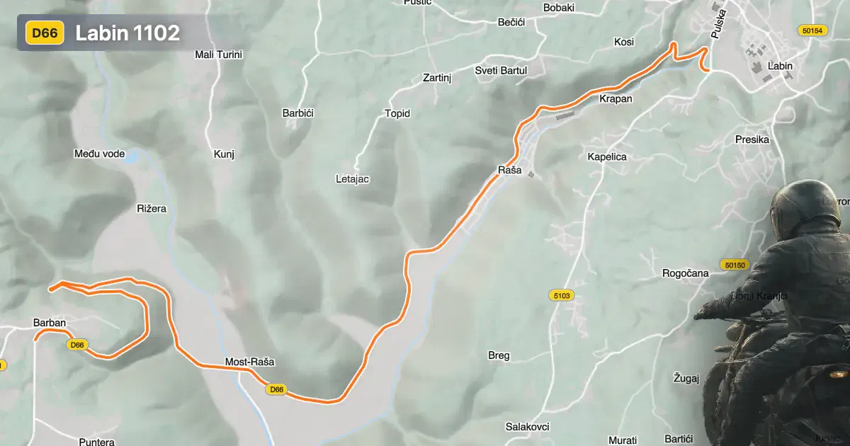
Labin 1102 is situated in the eastern part of the Istrian peninsula, within Croatia. The road primarily serves as a connector between the historic town of Labin and the settlement of Raša. The route is positioned close to the Adriatic coast, providing access to both inland and coastal destinations. The area is characterized by rolling hills and a mix of urban and rural landscapes, with the road itself lying at elevations ranging from sea level up to 227 m (745 ft). An interactive map showing the precise route of Labin 1102 can be found at the end of this article.
Loading road width, lane configuration, and surface quality dataOpen Map Explorer for More Road DetailsRoad Characteristics and Technical Details
Labin 1102 extends for approximately 14.3 km (8.9 miles), making it a relatively short but important regional road. The surface is asphalt and is rated as excellent, providing a smooth and predictable riding experience. The road is predominantly wide (about 100%), with two lanes throughout (about 99%), ensuring ample space for overtaking and maneuvering. The route is not particularly curvy, featuring gently curved sections that allow for consistent speeds and minimal technical challenge. The maximum speed limits along the road vary between 40, 50, and 70 km/h (25, 31, and 43 mph), reflecting the mix of inhabited and open areas. Approximately 19.4% of the road passes through inhabited zones, while the remainder traverses less developed countryside.
Local Attractions and Points of Interest
While the primary function of Labin 1102 is as a connector, the surrounding region offers several attractions worth noting. The town of Labin is renowned for its medieval old town, perched on a hilltop with panoramic views of the Adriatic Sea. Raša, at the other end of the route, is notable for its unique 20th-century architecture, having been established as a mining town during the Italian administration of Istria. Motorcyclists may also consider detours to the nearby coastal resort of Rabac, known for its beaches and clear waters. These destinations provide cultural and recreational opportunities in close proximity to the road.
Road Closures, Seasonal Considerations, and Regulations
Labin 1102 is open to motorcycles year-round, with no regular seasonal closures reported. The region experiences a mild Mediterranean climate, and winter conditions rarely necessitate road closures. Temporary closures may occur due to roadworks or local events, but these are typically announced in advance by local authorities. For up-to-date information on road status and any event-related closures, riders should consult the Croatian Automobile Club (HAK) website.
Tolls, Fees, and Practical Information
There are currently no tolls or entrance fees required to use Labin 1102. The road is part of the public regional network and is accessible without charge. However, toll conditions may change in the future, and riders are advised to verify the latest information before traveling. Comprehensive details about road tolls and fees in Croatia can be found on the HAK Toll Rates page.
| ROAD SCORE | ROAD ARTICLE |
|---|---|
4.2 | Exploring the Cres–Porozina Road: A Motorcyclist’s Guide to the Island of Cres |
4.9 | Exploring the Labin–Mošćenička Draga Road: A Motorcyclist’s Guide |
5.2 | Exploring the Brseč–Mošćenice Road: A Technical Overview for Motorcyclists |
| ROAD SCORE | ROAD ARTICLE |
|---|---|
8.7 | Riding the Poklon Pass: Exploring Županijska cesta 5047 through Učka Nature Park |
7 | Exploring the Rijeka–Gornje Jelenje Pass: A Motorcyclist’s Guide |
7 | Adriatic Route - Jadranska Magistrala - Velebit Coastal Route |