Exploring Croatia’s D414: The Pelješac Peninsula Motorcycling Route
Locals know best!
If you travel this road often or live close by you will be given a chance to provide your valuable rating soon! Sign in and stay connected.Location and Overview of the D414
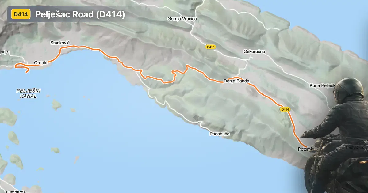
The D414, or Državna cesta D414, is situated on the Pelješac Peninsula in southern Croatia. The road serves as the main thoroughfare connecting the peninsula’s settlements, running from the vicinity of Korčula (the nearest major town to the starting point) to the village of Potomje. The route passes through several settlements, including Bana Josipa Jelačića, Postup, Dubravica, Obala dr. Franje Tuđmana, and Ulica bana Josipa Jelačića. The D414 is integral to the peninsula’s connectivity, providing access to both coastal and inland areas. An interactive map showing the road can be found at the end of the article.
Loading road width, lane configuration, and surface quality dataOpen Map Explorer for More Road DetailsRoad Characteristics and Riding Experience
The D414 extends for approximately 18.8 km (11.7 miles), with the majority of its length (about 93%) featuring two lanes and a wide carriageway (about 92%). The road surface is asphalt and is generally rated as excellent, offering a smooth and predictable ride. The route is gently curved, making it suitable for riders seeking a relaxed journey rather than a highly technical challenge. Elevation ranges from sea level (0 m / 0 ft) to a maximum of 414 m (1,358 ft), providing occasional panoramic views, particularly near the designated viewpoint attraction. The road passes through inhabited areas for roughly 43% of its length, so riders should anticipate variable traffic conditions and occasional pedestrian activity.
Speed Limits and Safety Considerations
Speed limits along the D414 vary depending on the segment, with posted limits of 50 km/h (31 mph), 40 km/h (25 mph), 90 km/h (56 mph), 60 km/h (37 mph), and 80 km/h (50 mph). Riders should remain attentive to changing speed zones, especially when entering or exiting settlements. The road’s width and surface quality contribute to a generally safe riding environment, but caution is advised in inhabited areas and at intersections. The presence of a viewpoint along the route offers an opportunity for a safe stop and a break from riding, with views over the peninsula’s distinctive landscape.
Tourist Attractions and Points of Interest
The D414 is notable for running alongside several attractions unique to the Pelješac Peninsula. The most prominent is the viewpoint, which provides expansive vistas of the Adriatic coastline and the peninsula’s vineyards. The road also passes near the historic village of Potomje, known for its wine production, and is within reach of the town of Korčula, a destination recognized for its medieval architecture and cultural heritage. These features make the D414 a practical route for riders interested in combining motorcycling with local exploration.
Road Closures, Tolls, and Practical Information
The D414 is open to motorcycles year-round and is not subject to regular seasonal closures. Temporary closures may occur due to roadworks or local events, so it is advisable to check current conditions before departure. There are no tolls or entrance fees for motorcycles on this road, but toll conditions may change in the future. For up-to-date information on road tolls and entrance fees in Croatia, refer to the official Hrvatske autoceste website. Riders should also be aware of local regulations and ensure their vehicles meet Croatian road safety standards.
| ROAD SCORE | ROAD ARTICLE |
|---|---|
4 | Exploring Lokalna cesta 69022: A Motorcycling Route on Korčula Island |
5.9 | Exploring the D414: The Kozje Ždrijelo Pass and Malostonski Zaljev Route |
4.6 | Riding the Žuljana–Trstenik Road: A Coastal Village Connection on the Pelješac Peninsula |
| ROAD SCORE | ROAD ARTICLE |
|---|---|
8.7 | Riding the Poklon Pass: Exploring Županijska cesta 5047 through Učka Nature Park |
7 | Exploring the Rijeka–Gornje Jelenje Pass: A Motorcyclist’s Guide |
7 | Adriatic Route - Jadranska Magistrala - Velebit Coastal Route |