Exploring the Poreč–Matohanci Coastal Road: A Motorcyclist’s Guide
Locals know best!
If you travel this road often or live close by you will be given a chance to provide your valuable rating soon! Sign in and stay connected.Location and Overview of the Poreč–Matohanci Road
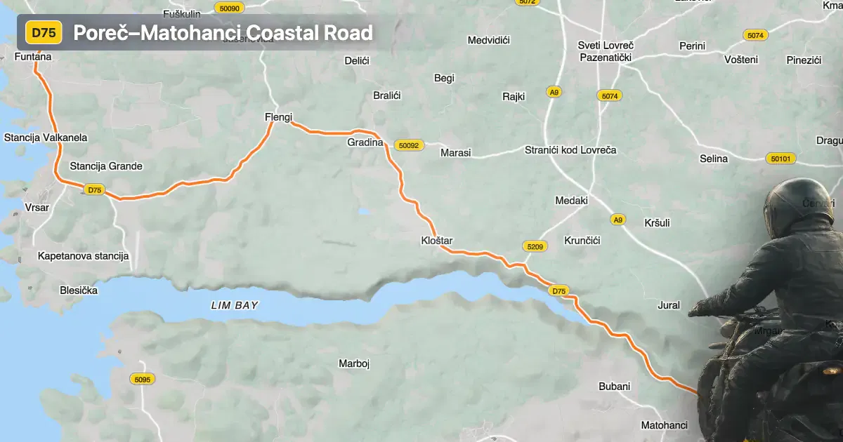
The Poreč–Matohanci road is situated in the Istria region of Croatia, connecting the coastal town of Poreč with the inland village of Matohanci. The route begins near Poreč, a well-known tourist destination on the western coast of the Istrian peninsula, and travels southeast towards Matohanci. The road closely follows the shoreline of the Gulf of Venice for a significant portion of its length, offering riders extended views of the Adriatic bay. An interactive map showing the road’s course can be found at the end of this article.
Loading road width, lane configuration, and surface quality dataOpen Map Explorer for More Road DetailsRoad Characteristics and Riding Experience
The Poreč–Matohanci road extends for approximately 18.7 km (11.6 miles), with the majority of its surface composed of high-quality asphalt. Riders will find the road to be gently curved, making it suitable for both novice and experienced motorcyclists seeking a relaxed ride. The surface quality is generally excellent, providing a comfortable and predictable riding experience. Most of the route consists of two lanes (about 96%), with the remainder being single-lane or slightly narrower sections. The road is predominantly wide (about 83%), allowing for easy overtaking and safe maneuvering, especially in the less inhabited stretches.
Elevation, Speed Limits, and Surroundings
The elevation along the Poreč–Matohanci road ranges from 4 m (13 ft) near the coast to a maximum of 172 m (564 ft) as the route moves inland. Speed limits vary along the road, typically ranging from 30 km/h (19 mph) to 60 km/h (37 mph), depending on the proximity to settlements and road conditions. Approximately a quarter of the route passes through inhabited areas, including the outskirts of Poreč and smaller settlements such as Istarska and Ulica sv. Martina. The remaining sections traverse open countryside and coastal stretches, providing a mix of urban and rural riding environments.
Tourist Attractions and Points of Interest
One of the highlights of this route is its alignment along the Gulf of Venice, a bay known for its historical significance and natural beauty. Riders can enjoy multiple viewpoints along the way, offering panoramic vistas of the Adriatic coastline. The proximity to Poreč allows for easy access to the town’s attractions, including the Euphrasian Basilica, a UNESCO World Heritage Site. The road’s coastal section is particularly appealing for those interested in combining motorcycling with sightseeing and photography.
Practical Information: Closures, Tolls, and Further Resources
There are currently no known restrictions or seasonal closures affecting motorcycles on the Poreč–Matohanci road. The route remains accessible throughout the year, although riders should be aware of occasional event-related closures or maintenance works, which are typically announced by local authorities. No tolls or entrance fees are required to use this road, but toll conditions may change in the future. For up-to-date information on road tolls and regulations in Croatia, refer to the official Hrvatske autoceste website. Riders are encouraged to check local resources before departure to ensure a smooth journey.
| ROAD SCORE | ROAD ARTICLE |
|---|---|
4.8 | Exploring the Boljunčica Valley Route: Županijska cesta 5046 for Motorcyclists |
4.3 | Exploring the Labin–Raša Route: A Technical Overview for Motorcyclists |
4 | Exploring the Buje 1139: A Motorcycling Route in Istria, Croatia |
| ROAD SCORE | ROAD ARTICLE |
|---|---|
8.7 | Riding the Poklon Pass: Exploring Županijska cesta 5047 through Učka Nature Park |
7 | Exploring the Rijeka–Gornje Jelenje Pass: A Motorcyclist’s Guide |
7 | Adriatic Route - Jadranska Magistrala - Velebit Coastal Route |